Yosemite
At the beginning of June, I had 2 random days off in the middle of the week.
Having just read an article in the Chronicle that way-above-average snowfall
in the Sierra's had made the waterfalls at Yosemite ginormous this year, I
decided spur-of-the-moment to go see what all the hubbub was about. This
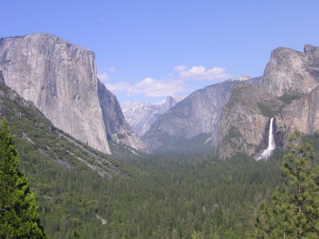
picture shows El Capitan to the left, Half Dome at the back of the valley, and
Bridalveil Falls on the right.
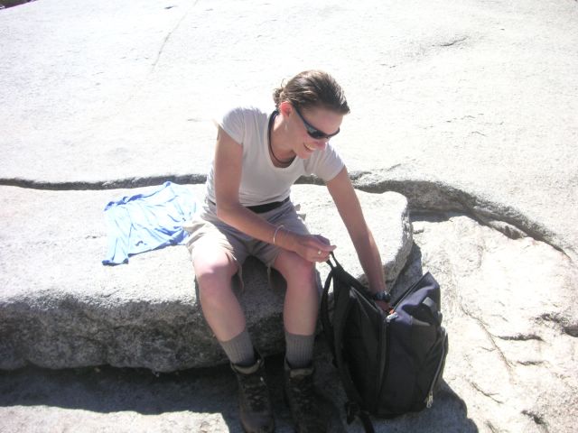
As luck would have it, the night before I left I happened to meet up with my
buddy and fellow peds resident, John Bahling, who had a friend visiting. She
was planning on making the trek to Yosemite at the same time, so we decided to
pool resources and go together. Here is the lovely and talented Andrea.
We left on a Tuesday evening and stayed outside the park, and then got up the
next morning and headed in. We had planned to hike the North Dome from the
back side so we could get good views of the valley and Half Dome, but our plans
were foiled because of the record winter snow. The high road of the park was
still completely snowed in, so we changed plans and hiked...
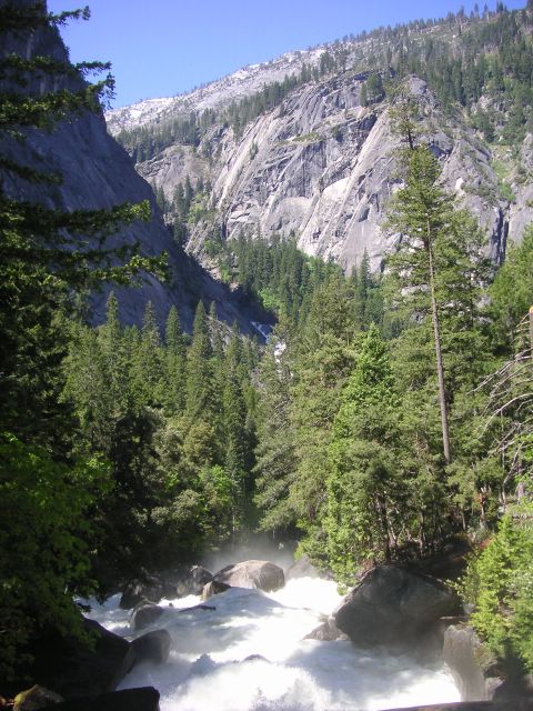
...up to Vernal Falls and then on to Nevada Falls and back. Here is a look upriver
at Vernal Falls along the Mist Trail.
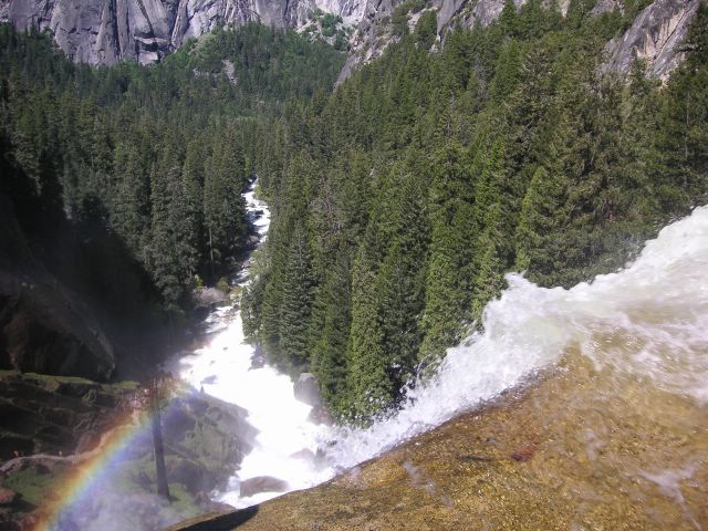
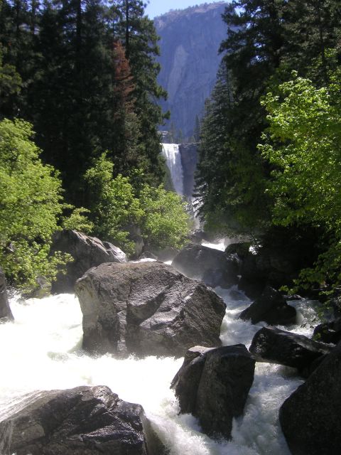
It is called the Mist Trail for a good reason. The trail hugs the cliff right next to
the falls, and you spend a good 15 minutes getting spray blasted in your face as
you navigate steep, slick granite steps to reach the top. Despite getting drenched
from the spray, you're rewarded with a nice view and a rainbow at the top.
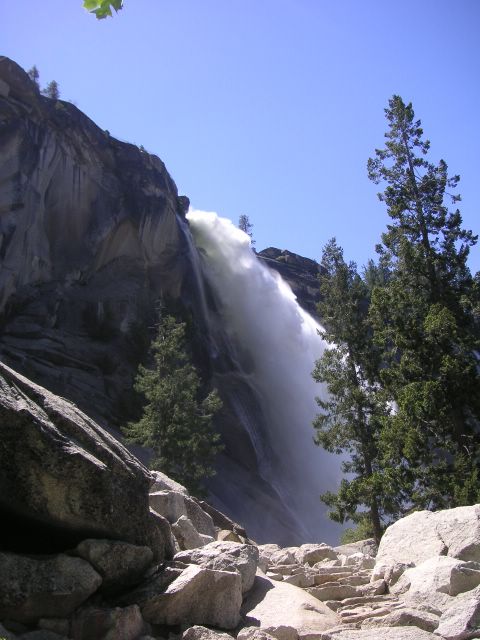
After sitting in the sun and drying off above Vernal Falls, we continued on and
headed up to Nevada Falls.
Purty.
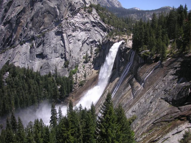
Here is the mouth of Nevada Falls. I was duly impressed by the massive quantity
of water pouring through the rivers. All the park rangers we talked to said that
they had never seen the falls so big.
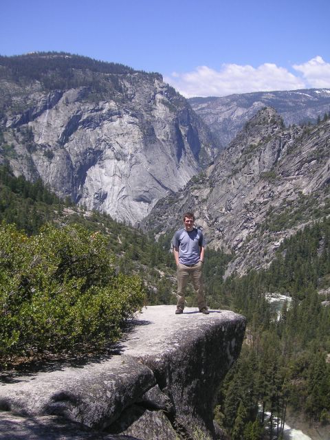
This picture was meant to scare my mom. In the end it doesn't look as treacherous
as I hoped it would.
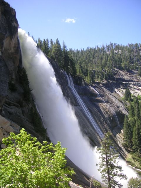
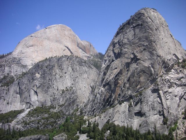
The trail then curved around the lip of the canyon offering great views of Nevada
Falls.
Purty, again.
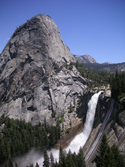
There's the backside of Half Dome on the left, which actually dwarfs Liberty Cap, pictured in the foreground on the right.
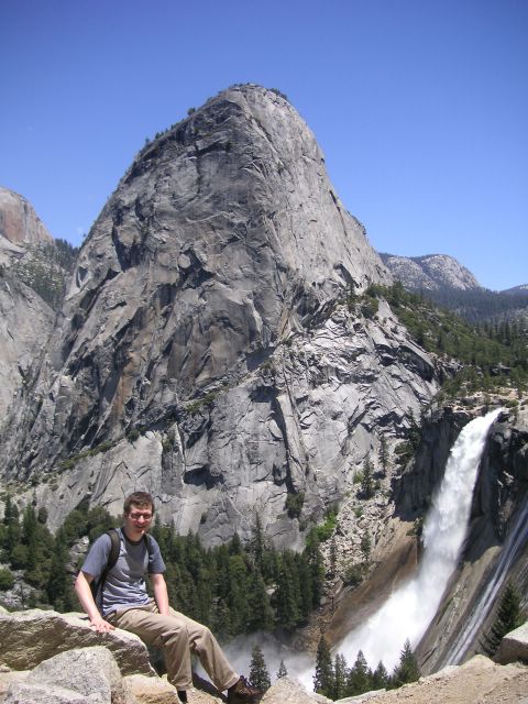
Carl Nosek Glamour Photo #245
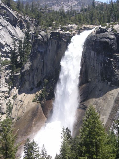
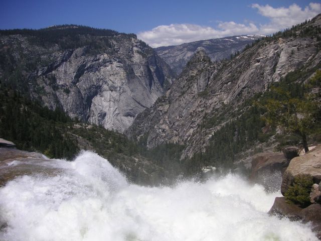
More Nevada Falls... seeing all this water kind of makes me need to go pee.
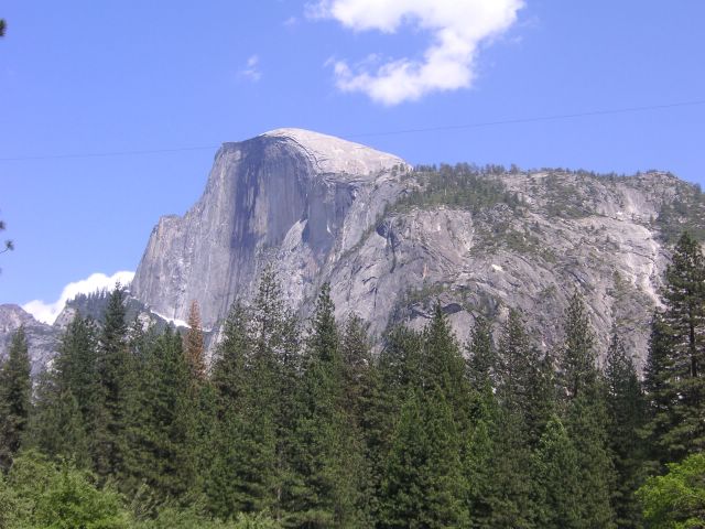
Here is the front side of Half Dome. The picture was actually taken from a
parking lot, but you wouldn't know it if I didn't tell you.
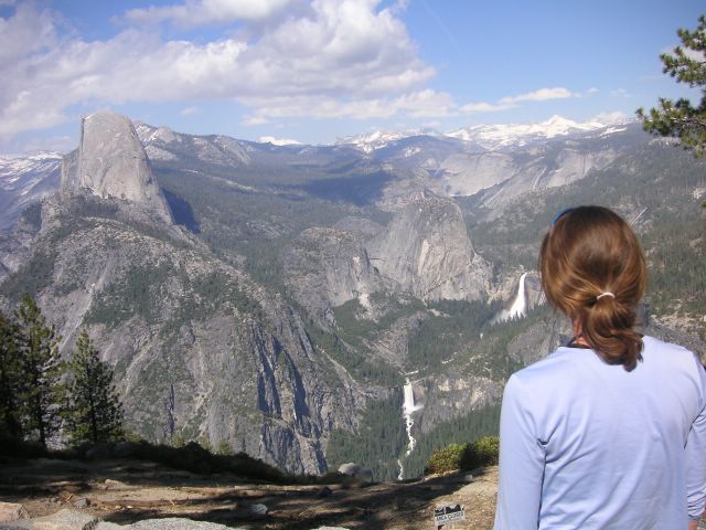
After the hike, Andrea and I went up to Glacier Point to take in the view. You
can see Half Dome to the far left, and the waterfall coming out of Andrea's ear
is Nevada falls. If you follow the river down, you can see Vernal Falls and get a
good birdseye view of the hike described above.
Due to the last minute nature of our trip and the closure of the high road (and all
of it's campsites) we couldn't snag a place to camp at Yosemite. We decided to
take advantage of the long daylight and head south. We ended up camping in Kings
Canyon National Park, pictured above. This park is actually the largest roadless
area in the lower 48, and was really gorgeous. This measley picture doesn't do it
justice. I think I might come back in September and do a 5-6 day hike here, so stay
posted.
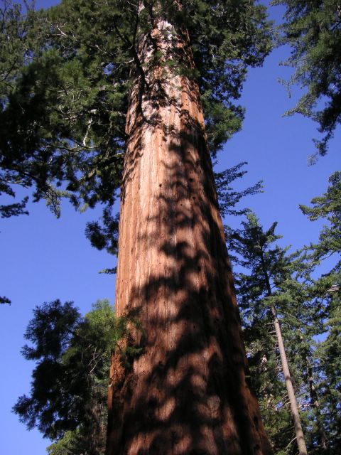
The next day we drove around Kings Canyon and Giant Sequoia Ntl. Monument.
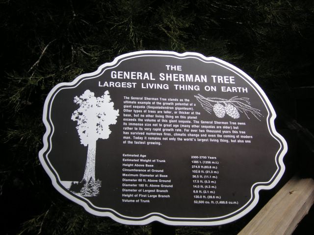
Giant Sequoia has 4 of the world's 6 largest living things within it's borders. #1 on
the list is the General Sherman Tree...
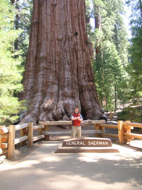
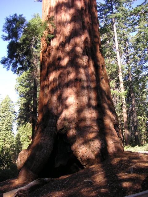
...Here it is posing with #4 and #6. The presence of my biceps (affectionately known
as "Thunder" and "Lightning") marked the first time in recorded history that the world's
top 6 largest living things were all in such close proximity.
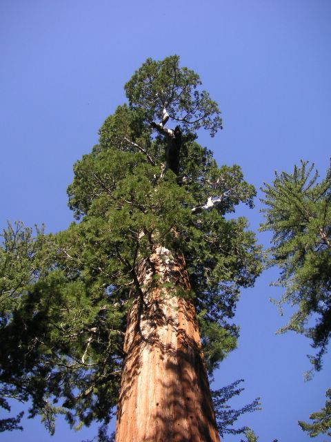
Here is a poor attempt to show how big these suckers really are. Squint your
eyes and pretend that the three pictures are one.
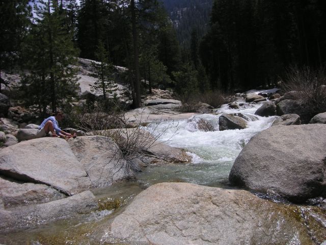
After getting a sore neck oogling the trees, Andrea and I went on a hike in Giant Sequoia
up to Tokopah Falls.
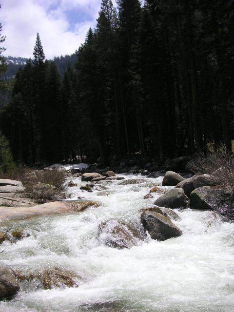
It followed the Tokopah river...
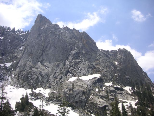
... and "The Watchtower" loomed over the valley the whole way.
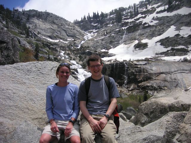
After the previous day's action at Yosemite, Tokopah Falls (seen behind us) was
kind of anticlimactic, but still pretty.
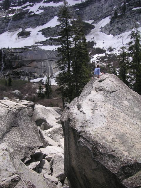
More climactic were the giant boulders at it's base that Andrea and I scrambled
around on. (Andrea provided for size comparison.)
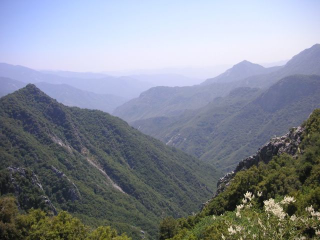
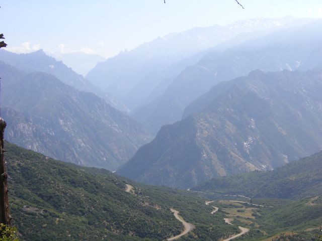
After the hike it was time to head home, but not without getting some great
views as we drove down the Kaweah Valley and headed towards the hazy, flat
Central Valley.
A good trip, and one that I want to redo with more time.
posted by Carl Nosek at 11:53 PM
![]()


0 Comments:
Post a Comment
<< Home